Monday, December 23

About Khagrachari District, Bangladesh


atlas of khagrachari hills


About Khagrachari District, Bangladesh


Khagrachari is a hill tracts district located in the south- eastern part of Bangladesh. The local name of the region is “Chengmi”. The Chittagong Hill Tracts was once under the reign of the Tripura State. The Arakans and the Sultans ruled the region in different times before it came under the control of the British East India Company in 1760. According to Notification No 3302 in 26 June 1860, Chittagong hill tracts were separated form Chittagong and declared as a new district. Due to the advantage for revenue collection, the greater Chittagong hill tracts were divided into three separate circles named Mong circle, Chakma Circle and Bomang Circle. After the liberation of Bangladesh, 10 September 1979, the old subdivisions were reformed to form newly three subdivision named Khagrachari, Kaptai and Lama. In 07 November 1983, Khagrachari District formed with formarly Kahagrachari and Ramgarh sub division. The Geo position of the district is between 22˚38’ to 23˚44’ North latitudes and between 91˚42’ to 92˚11’ east longitude.

Khagrachari District Bordered By-

Khagrachhari District is bordered by Tripura (Indian State) to the north, Rangamati and Chittagong district to the south, Rangamati district to the east, Chittagong district and Tripura (Indian State) to the west.

Administration: The area of Khagrachhari is 2749.16 Sq Km. It is under Chittagong Division. There are 03 Municipalities in Khagrachhari named Khagrachhari, Ramgor and Matiranga. The number of Upazilla (sub district) in Khagrachhari district is 09, named- Khagrachhari, Mohalchori, Manikchori, Panchori, Luxmichori, Dighinala, Matiranga, Ramgor and Merung containing 38 Unions, 120 Mauzas and 1702 Villages. 

Khagrachari District Population Data:

The total population of Khagrachhari district is 714,119 (Male- 3,57,521 and Female- 3,56,564), sex ratio is 100:100, tribal and non tribal ratio is 52:48, population density 259.80/Sq Km and annual growth rate is 1.40%. The Literacy Rate of Khagrachhari district is 71.80%, School attendance rate is 74.90% for 5 to 24 years age group.

Other Important Data: The postal code of Khagrachhari district is 4400 and NWD Code is 0371. Total Parliament seat in Khagrachhari is 01. During the liberation war, Khagrachhari was under Sector Number 01. Urbanization rate of the district is 35.15%. 

Rivers: Karnafuli, Halda, Bingri, Mainy, Feni, Chingri, Kasalong, Maini etc.

Agro Products: Tea, Maize, Ginger, Turmeric, Pine Apple, Papaya, Jack- fruit, Orange, Lemon, Banana, Oil seeds etc.

Khagrachari District Famous For-

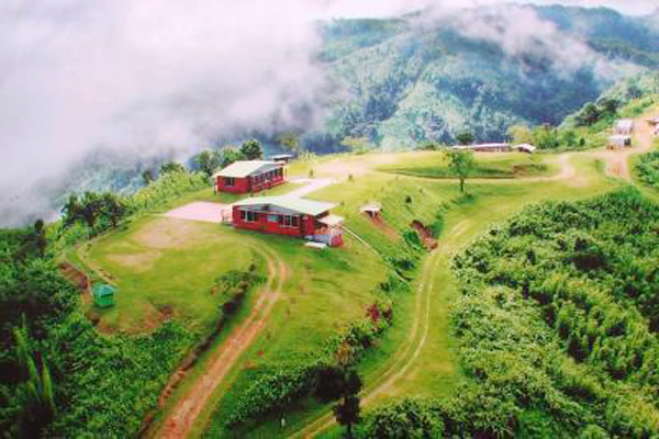
Khagrachari hilly district specially famous for its lovely landscape specially Sajek Valley. It's is also famous for ethnic diversity and cultural heritage. 

Remarkable Personalities from Khagrachari District

Samiran Dewan, Ananta Kumar Krishna, Nabin Tripura, Sahid Abdul Quader, Dr Niru Kumar Chakma, Moharany Nahar Debi, Anayanta Behari Thisha etc.
khagrachari hill tracts

Tourist Attractions in Khagrachari District

Manik Chori Mogh Rajar Residence, Ramgor Lake and Tea Garden, Alutila Mysterious Cave, Hill Tract Agricultural Institute project, Richhang waterfall, Nunchhori Debota Pond, Yonged Buddha Bihar, Dighinala Manikker Dighi and Touduchhori Waterfall, Dighinala Reserve Forest, Vagaban Tila, Shajek and Marissa Vally, Richhang Falls, Hundreds years Banyan tree (Matiranga) etc.

About Kishoreganj District, Bangladesh


atlas of khshoreganj, Bangladesh


About Kishoreganj District, Bangladesh


Kishoreganj is a district of central Bangladesh. In the ancient age the region was included in the Kingdom of Kamrupa. During the period of Mughal emperor Akbar, greater part of Kishoreganj was included in Mughal region. Some area including Jangalbari, Egarosindhu etc. In 1538 AD Ahom king was defeated and lost Egarosindhu and it was included in Mughal region and 1580 AD the Koch King of Jangalbari was defeated by Isha Kha, the commander of Mughal emperor. After the death of Isha Kha in 1599, the greater part of Kishoreganj was still under the rule of his son Musa Kha on behalf of Mughal king. Kishoreganj was familiarly known as ‘Katkhali’ till the end of 18Th century. It is guessed from historians that Kishoreganj was named after landlord Brojokishor alies Nondokishor when a bazaar (Gonj) named Kishorganj estanlished by him. The region has an ancient historical and traditional heritage. The prominent journalist and professor of English literature of Oxford University Mr Nirod Chowdhury wrote ‘Kishoreganj is my birth place’ with pride at the beginning of his writing ''The Autobiography of an unknown Indian.''

01 May 1787 the Mymensingh district was established in the Indian subcontinent. Kishoreganj was then the expansion of Mymensingh district. Kishoreganj sun division was formed in 1860 AD and current Kishoreganj district is formed in 1984 with the area of 2688.59 Sq Km under Dhaka division. Kishoreganj is famous for the largest Asian Idhgah named Solakia.

Kishoreganj District Bordered By-

Kishoreganj is bordered by Mymensingh, Netrokona and a part of Sunamganj District to the north, Narsingdi district to the south, Brahmanbaria and Habiganj districts to the east, Gazipur and Mymensingh districts to the west.

Administration: There are 08 Municipalities in Kishoreganj named Kishorgonj, Bajitpur, Katiadi, Pakunia, Hossainpur, Bharaib, Karimganj and Kuliacahr. The number of Upazilla (sub- district) in Kishoreganj district is 13, named- Kishorgonj Sadar, Karimgonj, Pakundia, Hossainpur, Itna, Mithamine, Tarail, Katiadi, Bajitpur, Kuliachar, Vharaib Bazar, Nikli and Ostragram containing 108 Unions, 841 Mauzas and 1725 Villages. 

Kishoreganj District Population Data:

The total population of Kishoreganj district is 33,73,219 (Male- 15,72,924 and Female- 16,94,546), sex ratio 99:100, Population Density 1255/Sq Km and annual growth rate is 0.96%. The Literacy Rate of Kishoreganj district is 72.54%, School attendance rate is 76.70% for 5 to 24 years age group.

Other Important Data: The postal code of Kishoreganj district is 2300 and NWD Code is 0941. Total Parliament seat in Kishoreganj is 06. During the liberation war, Kishoreganj was under Sector Number 03. Urbanization rate of the district is 16.79%.

Rivers: Old Brhamoputra, Fuleshwari, Ghorauttra, Meghna, Dhanu, Baulai, Norshunda, Sonai, Mogra, Baro Chinai, Singua, Suti, Arial Kha, Soaijani, Kali, Kula  etc.

Agro Products: Paddy, Jute, Wheat, Oil seeds, Pulses, Potato, Peanuts, Sugarcane, Vegetables, Banana, Palm, Litchi, Olive etc.


Kishoreganj District Famous For-

Kishoreganj is a A-grade district in Bangladesh Administration. Asian largest Solakiah Idgah located in Kishoreganj. Besides Kishoreganj is famous for Ostogram Haor and fish production as well.


Remarkable Personalities from Kishoreganj District

Chandraboti (Poet), Upendra Kishor Roy( Poet), Sukumar Roy (Poet), Moni Shingha (Politician), Abdul Monem Khan (Politician), Nihar Ranjan Roy (Historian) Diss Bongshi Das (Poet), Sattajit Roy (Film Personality), Sayad Nazrul Islam (Politician), Jahirul Islam (Industrialist and Social Worker), Rahat Khan (Journalist), Ataus Samad (Journalist), Nirod C. Chowdhury (Writer) Durgadas Vattacharja (Educationist) Jillur Rahaman (Politician), Major (Rtd) Akhtaruzzaman (Politician)  etc.

Kishoreganj


Tourist Attractions in Kishoreganj District

Historical Sholakia Idhgah, Darbar Hall, Eagaro Shindhur Fort, Jangalbari Fort and Mosque of Isha Kha, Pagla Mosque, Pramanik Bhaban and Lake, Poet Chandraboty Shibmondir, Hazrat Nagor Royal Palace, Jinda Bibir Mazar, Shah Mahmud Mosque and Balakhana, Dilir Akhra, Pagla Mosque, Residence of Poet Sukumar Roy, Jaharul Islam Medical College, Ganda Sundari Temple etc.


About Khulna District, Bangladesh


khulna city map


About Khulna District, Bangladesh 


Khulna district is located in the west southern part of Bangladesh. The previous name of the region was “Jalalabad”. Khulna was the first subdivision of joint Bengal during the east India Company Period. Khulna is one of the districts that were included with the current name in joint Bengal province. Khulna district is formed in 1882. At the time of Partition in 1947, Khulna was the 3rd largest district and now it is the 4Th largest district of Bangladesh. Independent Bangladesh was established in 16 December 1971, but Khulna was under the control of Pakistani Army. The Pakistani Army surrendered in the Circuit House ground in 17 December and Khulna got her Independence. The world largest mangrove forest Sundarban is in the greater Khulna region.

Khulna District Bordered By-

Khulna District is bordered by Jessore and Narail districts to the north, The Bay of Bengal to the south, Bagerhat district to the east, Satkhira district to the west.

Administration: The area of Khulna is 4394.45 Sq Km. It is a Divisional Headquarter also. There is a city corporation; two Municipalities in Khulna named Paikgacha and Dakope. The number of Upazilla (sub district) in Khulna district is 14, named- Khulna Sadar, Rupsha, Daulatpur, Batiaghata, Koyra, Terakhada, Dakop, Paikghacha, Dumuria, Fultala, Digholia, Khalishpur, Khan Jahan Ali and Sonadanga containing 70 Unions, 716 Mauzas and 1122 Villages outside of metro area.

Khulna District Population Data

The total population of Khulna district is 26,73,002 (Male- 13,12,166 and Female- 13,01,032), Sex ratio 100:100, Population Density 608.30/Sq Km and annual growth rate is  0.93%. The Literacy Rate of Khulna district is 88.07%, School attendance rate is 92.82% for 5 to 24 years age group.

Other Important Data: The postal code of Khulna district is 9000 and NWD Code is 041. Total Parliament seat in Khulna is 06. During the liberation war, Khulna was under Sector Number 08 & 09. Urbanization rate of the district is 33.54%.

Rivers: Rupsha, Bhairab, Pashur, Tandra, Shibsha, Kapotakkha, Shakbaria, Koyra, Vadra, Kazi Bacha, Atrai, Sholmari, Suterkhali etc.

Agro Products: Paddy, Jute, Pulse, Sesame, Jack fruit, Mango, Banana, Oilseed, Betel Nut, Coconut etc.

Khulna District Famous For-

Khulna is considered the gateway of Great Mangrove Forest Sundarban. Khulna is called the city of Shrimps. Around 75% national shrimps export contribute from Khulna region.


Remarkable Personalities from Khulna District

Abdus Sabur Khan (Politician and Social Worker), Kazi Akram Hossain, Kazi Imdadul Hoque (Novelist), Krishna Chandra Majumder (Poet), Acharja Prufulla Roy (Scientist), Muhammad Abu Talib (Poet), Shikandar Abu Jafor (Poet), Abul Hossain ((Poet), A. S. M. Samsul Arefin (Literate Personality), Gazi Samsur Rahaman(Writer), Shachindra Nath Sengupta (Play Personality), Hasan Azizul   etc.

khunla metro, bangladesh 

Tourist attractions in Khulna District

Sundarban, Hiron Poient, Dakkhin Dihi, Graveyard of Birshresta Ruhul Amin, Hardboard Mill, Newsprint Mill, Ship-Building Area, Prem-kanon, Jora-Ghet, Kalibari Temple, Khulna University, Children Park, Botanical Garden etc.


About Kurigram District, Bangladesh


atlas of kurigram


About Kurigram District, Bangladesh


Kurigram district is located in the west- northern borderline of Bangladesh. It is one of the ancient regions of primitive civilization. The first appearance of primitive human was in the Teesta and Brahmaputra Vally of the region. The combined bloodstream of Black, Astrict and Dravidian –Mongolian made its ancient civilization which is universally agreed non Arjo. Quit-India Movement, Tebhaga Movement, Satyagraha Movement etc are the remarkable chapters of the region. During the East India company period, Kurigram subdivision was formed in 22 April 1875. The previous name of the region was Kuriganj. Sir William Hunter mentioned the region as “Kuriganj” in his writing named Gazetteer of the Rangpur District. There is no enough evidence about the naming of Kurigram. But some Historians think that the word Kurigram came from “Kuri” (means 20 pieces). During the War of Liberation- Raumari, Rajibpur (except Kodalkati union) and Phulbari upazilas were beyond the reach of the Pakistani army. Many direct encounters between the Freedom Fighters and the Pakistani army were held in this region in which about 100 Freedom Fighters were martyred. After the liberation of Bangladesh, Kurigram started its journey as a district on 23 January 1984. The Geo position of the district is between 20˚03’ to 26˚03’ North latitudes and between 89˚27’ to 89˚47’ east longitude.

Kurigram District Bordered By-

Kurigram District is bordered by Kuchbihar district of West Bengal (Indian State) to the north, Gaibandha district to the south, Assam (Indian State) to the east, Rangpur and Lalmonirhat district and West Bengal to the west.

Administration: The area of Kurigram is 2245.04 Sq Km. It is under Rangpur Division. There are 03 Municipalities in Kurigram named Ulipur, Nageshwari and Kurigram. The number of Upazilla (sub district) in Kurigram district is 09, named- Kurigram Sadar, Ulipur, Chilmary, Nageshary, Vurungamari, Char-Rajibpur, Roumari, Rajarhat and Fulbari containing 72 Unions, 587 Mauzas and 1872 Villages. 

Kurigram District Population Data:

The total population of Kurigram district is 23,83,268 (Male- 11,45,851 and Female- 11,83,249). Sex ratio is 99:100, Population Density 1062/Sq Km and annual growth rate is 0.92%. The Literacy Rate of Kurigram district is 63.18%, School attendance rate is 54.00% for 5 to 24 years age group.

Other Important Data: The postal code of Kurigram district is 5600 and NWD Code is 0581. Total Parliament seat in Kurigram is 04. During the liberation war, Kurigram was under Sector Number 06 & 11. Urbanization rate of the district is 15.78%.

Rivers: Jamuna, Brahammaputra, Dharla, Tista, Dhudkumar, Fulkumar, Gongadhar etc. 

Agro Products: Paddy, Jute, Betel, Betel Nut, Peanut, Sugarcane, Wheat, Maize, Chilly, Bamboo, Vegetables etc.


Kurigram Dsitrict Famous For-

Kurigram is specially famous for Chilmary Land-Pord. Histrically Kurigram is famous for Agriculture. Huge agro products specially tobacco, potato grow plenty  in Kurigram. During freedom fighting period, many direct fights fought here between Freedom Fighters and pak army. 


Remarkable Personalities from Kurigram District

Taramon Bibi (Bir Protik), Sayad Samsul Hoque (Novelist), Abdul Hai Shikder, Bhabani Pathok, Sayad Munsur Ali, Tazul Islam etc.

durgapur high school, Kurigram

Tourist Attractions in Kurigram District

Shahid Freedom Fighter Monument, Rajarhat Sahi mosque, three domed mosque, Joymoni Royal Palace, Chandamari Mosque, Naodanga Royal Palace and Temple, Pangeshwari Temple and Remnants of the Royal Palace, Bhetarbandh Royal Palace, Kali Siddheshwari Temple, Chilmari Land Port, Two Canons of Panga Kingdom (Preserved at the BGB Gate), Chandi Temple of Ulipur,  etc.