About Feni District, Bangladesh
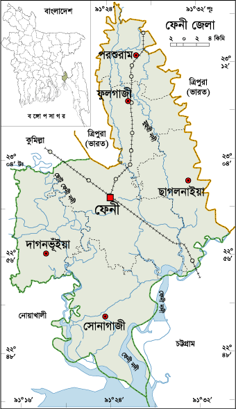
Feni is a small district located in the south- eastern part of Bangladesh. The previous meme of the region was “Samsernagor.” During the British East India Company Period, it was a sub district under Chittagong district. Then it was included in Noakhali district. After the liberation Feni started its journey as a district on 15 February 1984.
Why is Feni District Famous For?
Feni district is famous for natural viewpoint. Khondol Sweets, a traditional sweetmeat eaten in this region. Feni district has strategic importance in Bangladesh geography.
How many Thana and Union in Feni District?
The area of Feni District is 990.36 Sq Km. It is under Chittagong Division. There are 05 Municipalities in Feni named Feni, Dagonvhuyan, Sonagazi, Chagolnaya and Pashuram. The number of Thana in Feni district is 06 (six), named- Feni, Sonagazi, Chagolnaya, Porshuram, Fulgazi and Dagonvhuyan. There are 43 (Forty Three) Unions, 497 Mauzas and 553 Villages in Feni district.
Famous personalities from Feni District
Famous personalities born in Feni district are- Shah Syed Amir Uddin Pagla Miah/Baba( R) (regarded as founder of feni), Saint Mamu Fakir (R),Begum Khaleda Zia (former Prime Minister), Sir A. F. Rahman (the first Muslim Vice Chancellor of Dhaka University), Prof. A.K. Azad Chowdhury (Former Vice-Chancellor of Dhaka University and present Chairman of UGC), Dr. Mustafa Chowdhury (former Public Service Commission Chairman), Prof. Ahmed Shafee (Vice-Chancellor of East West University), Former Politician and Businessman Mowlana Abdul Wadud, Abdul Awal Mintu, Saber Hossen Chowdhury, Mosarraf Hossen, Economist Abu Ahammed, Abdus Salam (editor), Obaidul Haque, Johur Hossain Chaudhury, A. B. M. Musa, Gias Kamal Chowdhury, Iqbal Sobhan Chowdury, Iqbal Bahar Chowdhury, National press club president Kamal Uddin Sobuj, Columnist Masud Majumder, Former FBCCI President and Founder Chairman of North South University M A Kashem, Novelists Shahidullah Kaiser and Jahir Raihan, Renowned actor Shomi Kaisar, Language martyr Abdus Salam, martyred intellectuals during the war of liberation Selina Parvin, Playwrights Selim Al-din, Gias Uddin Selim, Freedom fighter:A.B.M. Bahar etc.
Tourist Attractions in Feni District
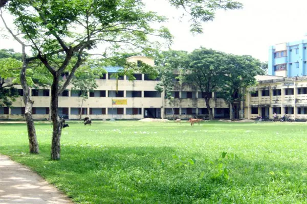
Tourist attractions in Feni district are- Graveyard of St. Pagla Mia, Muhuri Barrage, Sarsadi Mosque and Fort, Sasam gazi Fort and Armoury, Kachar Bari of Tripura Moharaza, Bijoy Sing Lake, Rajazhi Lake, Lalpur and Shuvapur Fort, BRRI, Feni Academy etc.
Feni District Bordered By-
Feni District is bordered by Comilla district and Tripura (Indian State) to the north, Chittagong district and the Bay of Bengal to the south, Tripura (Indian State) and Chittagong district to the east, NoakhaliDistrict to the west.
Feni District Population Data
The total population of Feni district is 16,97,379 (Male- 780,436 and Female- 868,416). Sex ratio is 93:100, Population Density 1714/Sq Km and annual growth rate is 1.10%. The Literacy Rate of Feni district is 80.79%, School attendance rate is 84.60% for 5 to 24 years age group.
Rivers in Feni District
Rivers flow through Feni district are- Feni, Little Feni, Mahuri, Dakatia, Selonai etc.
Agro Products from Feni District
Agro products grow plenty in Feni district are- Potato, Paddy, Jute, Wheat, Mango, Sugarcane, Jack Fruit, Coconut, Pulse etc.
Other Important Data: The postal code of Feni district is 3900 and NWD Code is 0331. Total Parliament seat in Feni is 03. During the liberation war, Feni was under Sector Number 02. Urbanization rate of the district is 20.44%.


