Monday, December 23

About Kushtia District, Bangladesh


atlas of kustia, Bangladesh


About Kushtia District, Bangladesh


Kushtia district is located in the western part of Bangladesh. The region has an ancient heritage of archaeological traditional culture and history. During the period of Mughal emperor Shahjahan, a river port was developed in the region. Kushtia was under the territory of Natore Landlord in 1725. Then in British East India Company period, the region was included in Jessore district in 1776. Again the territory of the region was reformed and included with Pabna district in 1828. A rail connection was constructed in this region to connect Calcutta, the capital of British India in 1860. According to Hamilton’s Gazette, current Kushtia town was mentioned as the name of Kustee. Then the town was called Kushtay (Kushtee) by the civilians. Kushtia municipality was established in 1861 to protect indigo registance movement. Kushtia was then a part of Nadia district under Bengal province. During the time of partion in 1947, it became a new district consisting three subdivisions named Kushtia Sadar, Chuadanga and Meherpur subdivisions. All these three subdivisions started their new journey as separate districts in 1984.

Kushtia District Bordered By-

Kushtia District is bordered by mighty Padma River to the north, Jhenaidah districts to the south, Rajbari district to the east, Mehaerpur, Chuadanga districts and Nadia & Murshidabad districts of West Bengal (Indian State) to the west.

Administration: The area of Kushtia is 1608.80 Sq Km. It is under Khulna Division. There are 05 Municipalities in Kushtia named Kumarkhali, Mirpur, Veramara, Kushtia, and Khoksha. The number of Upazilla (sub district) in Kushtia district is 06, named- Kushtia Sadar, Kumarkhali, Daulotpur, Mirpur, Veramara and Khoksha containing 66 Unions, 658 Mauzas and 973 Villages. 

Kushita District Population Data

The totoal population of Kushtia district is 21,49,692 (Male- 10,55,875 and Female- 10,93,724), Sex ratio 99:100, Population Density 1336/Sq Km and annual growth rate is 0.88%. The Literacy Rate of Kushtia district is 69.01%, School attendance rate is 74.60% for 5 to 24 years age group.

Other Important Data: The postal code of Kushtia district is 7000 and NWD Code is 071. Total Parliament seat in Kushtia is 04. During the liberation war, Kushtia was under Sector Number 08. Urbanization rate of the district is 12.10%. the previous name of the region was Nadia.

Rivers: Padma, Kaliganga, Kumar, Vairob, Gorai, Mathavanga, Noboganga, Hisna etc.

Agro Products: Paddy, Jute, Wheat, Tobaco, Oilseeds, Corn, Potato, Pulse, Sugarcane, Spices, Vegetables, etc.


Kushtia District Famous For-

Kushtia district is historically famous for Shilaidaha Kuthibari and Fakir Lalon Shah. Kushtia is also famous for Islamic University located in Shailkupa Upazila. 


Remarkable Personalities from Kushtia District

Fakir Lalon Shah, Akkhoy Kumar Moytreae (Writer), Abul Kalam Azad (Writer and Literate Personality), Akbor Hossain (Novelist), Azizur Rahaman (Poet), Kangal Harinath (Journalilst and Writer), Jagadish Gupta (Novelist), Jabeda Khanom (Writer), Mir Mosharrof Hossain (Writer), Atower Rahaman, Shah Azizur Rahaman (Former Prime Minister), Abul Ahsan Chowdhury (Writer and Researcher), Nazmul Alam, Rafiqual Islam PSC, Barister Amirul Hoque, Pari Sundari (Leader of Indigo Resistance Movement), Abdul Jabber (Singer), Farida Pervin (Singer), Bagha Jatin (Leader of Sadeshi Movement), Golam Kibria, Alauddin Masud Rumi, Kazi Motaher Hossain (Writer), Azizur Rahaman (Poet), Akbor Hossain (Novelist) etc.

Rabindra Kuthibari, Kushtia


Tourist Attractions in Kushtia District

Rabindra Kuthibari of Shelaidaha, The shrine of Fakir Lalon Shah, Living Place of Mir Mosharrof Hossain, Jhaudia Shahi Mosque, Gorai River, Kushtia City Municipality House, Islamic University etc.


Sunday, December 22

About Lakshmipur District, Bangladesh


atlas of lakshmipur District


About Lakshmipur District, Bangladesh


Lakshmipur district is located in the south eastern part of Bangladesh. The region was a part of the kingdom of Bhulua at the beginning of the thirteenth century. Lakshmipur is said to have been a military outpost during the Mughals and East India Company period. From the sixteenth to the nineteenth century this area used to produce huge quantity of salt and cotton based high quality fabrics and exported also. Formerly Salt house and Joss houses of East India Company control these businesses. The inhabitants of this region had important role in the indigo resistance movement, Sannyasi uprising, Swadeshi movement, Debt Arbitration Movement etc. During the Swadeshi Movement great soul of the subcontinent Mahatma Gandhi visited through the district and stayed at Kafilatali Akhra and at Sreerampur Royal Palace in Ramganj. Our national poet Kazi Nazrul Islam visited Lakshmipur town in June 1926. On this occasion, a silver plate and a silver cup were presented to the poet on behalf of the inhabitants of the town. After the liberation of Bangladesh current Lakshmipur district was formed in 1984.

Lakshmipur District Bordered By-

Lakshmipur District is bordered by Chandpur district to the north, Bhola and a part of Noakhali district to the south, Noakhali district to the east, Bhola and Barisal district to the west.

Administration: The area of Lakshmipur is 1440.39 Sq Km. It is under Chittagong Division. There are 04 Municipalities in Lakshmipur named Luxmipur, Ramgonj, Raypur and Ramgoti. The number of Upazilla (sub district) in Lakshmipur district is 05, named- Luxmipur, Ramgonj, Raypur, Ramgoti and Kamal Nagor containing 58 Unions, 455 Mauzas and 547 Villages.

Lakshmipur District Population Data

The total population of Lakshmipur district is 19,37,948 (Male- 913,099 and Female- 10,24,763). Sex ratio is 99:100, Population Density 1345/Sq Km and annual growth rate is 1.00%. The Literacy Rate of Lakshmipur district is 62.26% school attendance rate is 71.00% for 5 to 24 years age group.

Other Important Data: The postal code of Lakshmipur district is 3700 and NWD Code is 0381. Total Parliament seat in Lakshmipur is 04. During the liberation war, Lakshmipur was under Sector Number 02. Urbanization rate of the district is 15.21%.

Rivers of Lakshmipur District

Meghna, Dakatia, Katkhali, Rahamatkhali, Vulua, Jarirdona etc. Total river area of the district is 118 Sq Km which is about 23% of the total area of the district.

Agro Products: Paddy, Betel Nut, Coconut, Peanuts, Soya-bin, Wheat, Potato, Yam, Jute, Chili etc.

Lakshmipur District Famous For-

Historically Lakshmipur district is famous for military outpost in Mughal and East India Company Period. From the Sixteenth to Nineteenth century, the region was famous for huge amount of salt production and export the same. 

Remarkable Personalities from Lakshmipur District

Kazi Motaher Hossain (Writer), Mohammad Ullah (Politician), Prof. Munir Chowdhury (Martyred Intellectual), Ferdausi Majumder (Actress), Sanaullah Nuri, Mofazzal Hayder Chowdhury, Prof. Kabir Chowdhury, Dr Mujaffar Ahmed Chowdhury, Abul Ahsan Chowdhury (First Secretary General of SAARC), Dr Abdul Motin Chowdhury (Former VC of Dhaka University), Mohammad Ullah (Former President) A. S. M. Abdur Rob (Politician), Ruhul Amin (Former Chief Justice), Dilara Jaman (Actress), Ramendra Majumder (Cultural Personalities) etc.

Lakshmipur District, Bangladesh


Famous Tourist Attractions in Lakshmipur District

Meghna River, Moju Chowdhuri Hat, Puro Children Park, Upozila sader Mosque Bagbari, Archaeological heritage Tita Khan Jami Mosque, Lawrance Bazar Baitul Aman Mosque, Abdullahpur Jami Mosque, Sahapur Neel-kuthi, Komol Nagor Hafijul Hoque Patowary Bari Sahapur Saheb-bari, Zamindar house at Dalal Bazar, Srigovinda Mahaprabhu Jeu Akhra, Dalal Bazar Math, Khoa-sagor Lake, Oidara Lake, Kamala Sundari Lake, Nager Lake, Jinn's Mosque, Rani Bhabani Kamada Moth, Sreerampur Rajbari, Shyampur Dayra Sharif, Kachua Dargah, Harishchar Dargah, Kanchanpur Dargah, Samitir Hat Cyclone Center, Machhum shah Fakirer Mazar,.Lakshmipur college, Lakshmipur Adarsha Samad Govt. High School, Dalal bazar Khoa Sagar Lake etc.


About Lalmonirhat District, Bangladesh


atlas of Lalmonirhat District


About Lalmonirhat District, Bangladesh


Lalmonirhat district is located the northern borderline area of Bangladesh. The previous name of the region was “Kamrup Kingdom” when it was once under Kamrup rule. There are many myths about the naming of the region. Some historians think that in the 19Th century when Bengal Duars Rail line was constructed, workers found red (Lal) stone mining in the land of the region. Then it is named Lalmoni and later Lalmonirhat. Some historians think that a female farmer’s leader named Lalmoni along with Nuruldin fought against British soldiers and local landlord and sacrificed her live to establish the rights of the farmers in 1783. Then the region named after her. With the passing of time “Hat” included with the word “Lalmoni” and named Lalmonirhat. During the war of liberation the headquarters of Sector No. 6 was located at Burimari of Lalmonirhat district. Lalmonirhat achieved liberation in 6 December 1971. 01 February 1984 Lalmonirhat subdivision upgraded into district. The Geo position of the district is between 25˚48’ to 26˚27’ North latitudes and between 88˚38’ to 89˚36’ east longitude.

Lalmonirhat District Bordered By-

Lalmonirhat District is bordered by Kuchbihar and Jalpaiguri district of West Bengal (Indian State) to the north, Rangpurdistrict to the south, Kurigram district and Kuchbihar district of West Bengal to the east, Rangpur and Nilphamary districts to the west.

Administration: The area of Lalmonirhat is 1247.37 Sq Km. It is under Rangpur Division. There are two Municipalities in Lalmonirhat named Lalmonirhat and Patgram. The number of Upazilla (sub district) in Lalmonirhat district is 05, named- Lalmonirhat Sadar, Patgram, Aditmary, Kaligonj and Hatibandha containing 67 Unions, 564 Mauzas and 919 Villages.

Lalmonirhat District Population Data

The total population of Lalmonirhat district is 14,61,589 (Male- 714,500 and Female- 713,864). Sex ratio is 100:100, Population Density 1172/Sq Km and annual growth rate is 1.00%.

Literacy: The Literacy Rate of Lalmonirhat district is 65.00%, school attendance rate is 71.00% for 5 to 24 years age group.

Other Important Data: The postal code of Lalmonirhat district is 5500 and NWD Code is 0591. Total Parliament seat in Lalmonirhat is 03. During the liberation war, Lalmonirhat was under Sector Number 06. Average rainfall of the district is 293.10 cm and urbanization rate of the district is 10.29%. 

Rivers in Lalmonirhat District-

The main rivers of Lalmonirhat distirct Teesta, Shingmari, Dharla etc. 

Agro Products: Paddy, Jute, Sugarcane, Tobacco, Wheat, Cor, Potato, Tomato, Onion, Chili, Raids, Cauliflower, Cabbage, Peanuts, Maize, Oilseed, Mango, Jack fruit, Betel- Nut, Litchi, Papaya etc.

Lalmonirhat District Famous For-

Lalmonirhat District famous for Tin-Bigha Koridor and Burimari Land port. An air base of second world war located in Lalmonirhat.

Remarkable Personalities from Lalmonirhat District

Sheikh Fazlul Karim (Poet), Nuruddin (Farmer Leader), Fakir Maznu Shah (Leader of Fakir Movement), Ramanimohon Roy Chowdhury (Land Lord), Kazi Sheikh Riazuddin (Educationist and Politician), Sherajul Hoque (Poet), Asraf Ali (Language Fighter), Dr Shafia Khatun (Language Fighter and Educationist), Abid Ali (Language Fighter) etc.


Tourist Attractions in Lalmonirhat District

Three Bigha Corridor and Dohogram & Angorpota Enclaves, Tush Vander Royal Palace, Teesta Rail Barrage, Graveyard of Ondha Huzur, Chirstchian Missionary College, Air Port, Pateshari Mondir, Hatibandha Hat, Nidaria Mosque, Sindhumati Lake, Hussain Sarabor (Dry Pond), Hala Boter Tol (An ancient banyan tree), Dharla Bridge, Kakina Rajbari, Kabi Bari (house and collections of poet Sheikh Fazlul Karim), etc.


About Madaripur District, Bangladesh


atlas of madaripur


About Madaripur District, Bangladesh


Madaripur district was named after great sufi saint Badaruddin Shah Madar. In the British East India Period, Madaripur started its journey as a subdivision in 1854 under Bakerganj (current Barisal) District. The region was separated from Bakerganj and included in Faridpur district in 1873. The subdivision was turned into a district in 01 March 1984. During the Liberation war, many direct encounters were held in the region between the freedom fighters and the Pakistani army. The freedom fighters of Madaripur captured 40 Pakistani soldiers including a Major and a Captain also. The Geo position of the district is between 23˚ to 20˚30’ North latitudes and between 89˚56’ to 90˚21’ east longitude. There is no reserve forest in Madaripur district but coconut, date, palm etc grow abundantly in the region. Madaripur is famous for date juice based raw sugar.

Madaripur District Bordered By-

Madaripur District is bordered by Munshiganj and Faridpur districts to the north, Gopalganj and Barisal districts to the south, Shariatpur district to the east, Gopalganj and Faridpur districts to the west.

Administration: The area of Madaripur is 1125.69 Sq Km. It is under Dhaka Division. There are 03 Municipalities in Madaripur named Madaripur Sadar, Shibchar and Rajair. The number of Upazilla (sub district) in Madaripur district is 04, named- Madaripur Sadar, Shibchar, Rajair and Kalkini containing 59 Unions, 479 Mauzas and 1062 Villages. 

Madaripur District Population Data

The total population of Madaripur district is 12,93,027 (Male- 615,762 and Female- 677,201). Sex ratio is 99:100, Population Density 1149/Sq Km and annual growth rate is 0.92%. The Literacy Rate of Madaripur district is 74.84%, School attendance rate is 55.50% for 5 to 24 years age group.

Other Important Data: The postal code of Madaripur district is 7900 and NWD Code is 0661. Total Parliament seat in Madaripur is 03. During the liberation war, Madaripur was under Sector Number 02 and 08. Urbanization rate of the district is 13.53% and average rainfall 2105 mm.

Rivers: Padma, Meghn, Arial Kha, Kumar, Palordi etc.

Agro Products: Paddy, Jute, Wheat, Pulse, Onion, Garlic, Chilly, Sugarcane, Vegetable etc.


Madaripur District Famous For-

Historically Madaripur district is famous for jute business and jute industry. Madaripur is also famous for Shokuni Lake located is Sadar Upazila.


Remarkable Personalities from Madaripur District

Chitra Preya Ray Chowdhury, Nirendra Nath Dasgupta, Khan Shaheb Alimuddin Ahmed, Joges Chandraa Biswas, Dr Johara Kazi, Fazlur Rahaman Khan (Architect), Fanivhushan Majumder, Sheikh Samsul Hoque (Writer), Prof. Anisuzzaman (Educationsit), Vupen Kumer Datta (Writer), Chand Mohon Chattergy (Writer), Sayad Abul Hossain (Politician), Sunil Gangopaddhya (Indian Novelist), Captain Alamgir Satter (Birprotik),  etc.
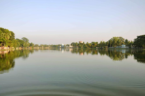
 landscape of madaripur


Tourist Attractions in Madaripur District

Graveyard of Khaza Yousuf Shah, Nilkuthi of Danlf, Home of Poet Kiron Chandra, Royal Palace of Sishir Ganguli, Annaypurna Temple, Pronob Moth, Graveyard of Chittyapriya Roy Chowdhury, Porbot Garden of Mustafapur, Shakuni Lake, Home of Land Lord Premchand Roy and D. L. Roy Chowdhury, Noboratna Temple, Dargah of Shah Madar, Bajitpur Pronabanda Temple, Kadambari Ganesh Pagol Temple, Khalia Rajaram Roy's House, Arialkha River, The Madaripur Lake, Sakuni Lake, Jhaudi Giri, Shrine of Hazrat shah Mader, Auliapur Indigo Kuthi etc.