Wednesday, December 18

Panchagarh District Information


atlas of panchagarh district


Panchagarh District, Bangladesh


Panchagarh district is located in the northern tip of Bangladesh. The previous name of the region was “Pancha- Gaura”. During the British East India Company period, Panchagarh was a police station under Jalpaiguri district of West Bengal. At the time of the partition of 1947, it was under Dinajpur district. Sannyasi and Fakir Revolt (1763-1800), Tebhaga Movement (1946) etc are the remarkable chapters of the region. It was turned into a subdivision in 1980 and upgraded to a district on 01 February 1984. The area of Panchagarh district is 1404.62 Sq Km.

Panchagarh District Bordered By

Panchagarh District is bounded by 288 Km long border of Darjeeling district (India) in the north, Dinajpur and Thakurgaon districts in the south, Nilphamary district in the east, Dinajpur district and West Bengal (Indian State) in the west.

Administration: The district is under Rangpur Division. There are two Municipalities in Panchagarh named Boda and Panchagarh. The number of Upazilla (sub district) in Panchagarh district is 05, named- Panchagor, Boda, Tetulia, Debigonj and Atoary containing 67 Unions, 564 Mauzas and 919 Villages. 

Panchagarh District Population Data

The total population of Panchagarh district is 11,79,843, sex ratio 101:100, population Density 840/Sq Km and annual growth rate is 1.60%.

Literacy: The Literacy Rate of Panchagarh district is 73.66%, school attendance rate is 76.29% for 5 to 24 years age group.

Other Important Data: The postal code of Panchagarh district is 5000 and NWD Code is 0568. Total Parliament seat in Panchagarh is 02. During the liberation war, Panchagarh was under Sector Number 06. Urbanization rate of the district is 9.63%.

Rivers: Kartoa, Mohanonda, Atrai, Tangon, Teesta, Nagor, Dahuk, Chawai, Tirnoy, Talma, Kurum, Versa etc.

Agro Products: Paddy, Jute, Potato, Sugarcane, Wheat, Vegetables, Tea, Mango, Jack fruit, Guava, Coconut, Litchi, Banana, Black Berry, Papaya, Guava, Coconut, Betel- Nut etc.

Remarkable Personalities from Panchagarh District

Comrade Mohammad Farhad, Advocate S. Bosirul Alam,  Mohammad Sultan (Language Fighter), Mirza Golam Hafiz (Politician), Abdur Rahaman (Film Hero), Jamir Uddin Sarker (Politician), Gobindra Chakroborti, Nazmul Hoque Prodhan, Safiul Alam Prodhan (Politician), Advocate Shirajul Islam (Freedom Fighter), Tarikul Alam etc.

banglabandha zero poient


Tourist Attractions in Panchagarh District

Panchagor Suger Mill, Rocks Museum, Banglabandha Land Port, Bodeshari Temple, Mirgor, Mirzapur Mosque and Royal Palace, Kartoa Bridge, Core of First Rail-Line of British-India, Railway Colony, Domar Royal Palace, Golkadham Mondir, Moghla Fort, Moydan Lake, Boda Temple, Moharajar Lake, three domed mosque at Mirzapur, Aloakhoa Royal Palace, Dak Banglo (Situated on the bank of river Mahananda facing Darjeeling), Tea Garden, Bhadreswar temple, Shiva-temple, Maharaja Dighi, Vadeswari mosque, Vadeswari temple, Govinda temple, Debiganj Revenue office building, Jagabandhu Thakur-bari, Shurjopuri Aam Gachh (Mango tree), Residence of Raja (King) Tonkonath, Gobindojiu Temple, Harinmari Shibmondir, Baliadangi Shibmondir etc.

Patuakhali District Information


atlas of patuakhali district


Patuakhali District, Bangladesh


Patuakhali district is located in the south- western coastal area of Bangladesh. The region was once under the the ancient kingdom of “Chandradip” and Kachua under Baufal upazila was the capital of the Chandradip. Due to natural calamities in very often on the coastal area and the frequent attacks of Magh pirates, the capital was transferred to Madhabpasha in Barisal. The forestry area of Chandradvipa was separated from Chandradip and marked as Bazuha (means protected region). In the last decade of the eighteenth century, a number of Buddhist Rakhains of Arakan settled at Rangabali Island, Khepupara and Kuakata regions. Since then human settlement began to grow in this region.

Patuakhali was a subdivision of the then Bakerganj district and upgraded into a district on 01 January 1969. The called name of the region is “Sagorkonnya” (the daughter of sea) because of locating the world famous Kuakata sea beach in the region. The Geo position of the district is 22˚19’60’’ North latitudes and 90˚19’60’’ east longitude.

Patuakhali District Bordered By

Patuakhali District is bordered by Barisal district to the north, The Bay of Bengal and Barguna district to the south, Bhola district and Tetulia River to the east, Barguna district to the west.

Administration: The area of Patuakhali is 3221.31 Sq Km. It is under Barisal Division. There are 05 Municipalities in Patuakhali named Patuakhali, Kalapara, Bawfal, Kuakata and Golachipa. The number of Upazilla (sub district) in Patuakhali district is 08, named- Patuakhali, Mirzagonj, Bawfal, Golachipa, Kolapara, Dasmina, Dumki and Rangabali containing 71 Unions, 561 Mauzas and 878 Villages. 

Patuakhali District Population Data:

The total population of Patuakhali district is 17,70,096, Sex ratio 96:100, Population Density 549.50/Sq Km and annual growth rate is 0.92%.

Literacy: The Literacy Rate of Patuakhali district is 76.70%. School attendance rate is 76.41% for 5 to 24 years age group.

Other Important Data: The postal code of Patuakhali district is 8600 and NWD Code is 0441. Total Parliament seat in Patuakhali is 04. During the liberation war, Patuakhali was under Sector Number 09. Urbanization rate of the district is 13.14%.

Rivers: Tetulia, Lohalia, Agunmukha, Laukathi, Andharmanik, Payra, Bura, Gouranga, Lebukhali, Pangshia etc. All the rivers flow to the Bay of Bengal.

Agro Products: Paddy, Jute, Betel-Nut, Coconut, Vegetables, Mango, Guava, Papaya, Orange, Pineapple etc.

Remarkable personalities from Patuakhali District

Rebal Satindranath Sen, Comrade Hiralal Das Gupta, Mustafa Mojid, Altaf Hossain Chowdhury (Politician), Sayad Ashraf Hossain, Advocate Shahjahan Mia (Politician), Abdul Karim Mia, Khandaker Abdul Khalek (Poet) etc.

landscape of bay of bengal


Famous Tourist Places in Patuakhali District

Kuakata Sea Beach Called the Daughter of Sea, Kuakata Buddhist Temple, Rakhain Palli, Komol Rani Lake, Core of the Capital of Chandradip Kings, Doyamoye Debi Temple, Gurinda Mosque, Graveyard of Yearuddin Khalifa, Kalu Kha Mosque, Baruk Kha Bridge, Annar Killa, Patuakhali University of Science and Technology, Dasmina Kabiraj Bari Lake etc.


Pirojpur District Information


atlas of pirojpur district


Pirojpur District, Bangladesh


Pirojpur district is located in the south- western part of Bangladesh. Most of the land of the region is low laying plane and 10 to 19 feet above from sea level. It is said that Pirojpur was named after Landlord Firoj Shah, the son of Shah Suja. At the first time the region was named “Firojpur” and by the passing of time the word Firojpur slowly muted to Pirojpur. During the East India company period, the pirojpur subdivision was formed in 1866. After the liberation of Bangladesh Pirojpur subdivision was upgraded into district in 01 March 1984. Peasant Rebellion (1757), Indigo Resistance movement etc are the remarkable chapters of the region. The Geo position of the district is between 22˚30’ to 22˚52’ North latitudes and between 89˚52’ to 90˚13’ east longitude.

Pirojpur District Bordered By

 Pirojpur District is bordered by Barisal and Gopalganj districts to the north, Barguna district to the south, Jhalokati and Barguna districts to the east, Bagerhat district and the Sundarban, the largest mangrove forest to the west.

Administration: The area of Pirojpur is 1277.80 Sq Km. It is under Barisal Division. There are 03 Municipalities in Pirojpur named Pirozpur, Nesarabad and Mothbaria. The number of Upazilla (sub district) in Pirojpur district is 07, named- Pirojpur Sadar, Vandaria, Mathbaria, Zianagor, Nazirpur, Sharupkathi and Kaukhali containing 51 Unions, 390 Mauzas and 648 Villages. 

Pirojpur District Population

The total population of Pirojpur district is 11,98,195, Sex ratio 100:105.60, Population Density 938/Sq Km, annual growth rate is 0.53%.

Literacy: The Literacy Rate of Pirojpur district is 85.53%. School attendance rate is 88.09% for 5 to 24 years age group.

Other Important Data: The postal code of Pirojpur district is 8500 and NWD Code is 0461. Total Parliament seat in Pirojpur is 04. During the liberation war, Pirojpur was under Sector Number 08 & 09. Urbanization rate of the district is 16.41% and distance from capital city Dhaka is 184 Km. Average rainfall of the region is 2240 mm.

Rivers: Gabkhan, Baleshwar, Damodar, Kocha, Pona, Kochakhali, Kaligonj, Sandha etc.

Agro Products: Paddy, Jute, Sugarcane, Wheat, Guava, Banana, Coconut, Hog-plum, betel leaf, betel nuts etc.


Remarkable Personalities from Pirojpur District

Poet Begum Sufia Kamal, Ahsan Habib (Poet), Moinur Ahsan Saber, Sayad Azizur Hoque(Poet), Tofazzal Hossain Manik Mia (Journalist), Moazzem Hossain, Biswajit Ghosh, Barister Moinul Hossain, Juwel Ice (Magician), Mawlana Abdur Rahim, Major General (Rtd.) Nurul Islam, Dr Khitish Chandra Mondol, Anower Hossain Monju (Politician), Leader Mahiuddin Ahmed, M. U. Ahmed, Manik Miah etc.

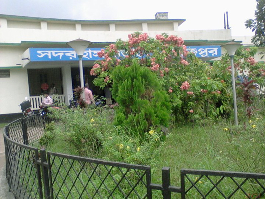
pirojpur sadar hospital


Tourist Attractions in Pirojpur District

Mothbaria Shapjora Kuthibari, Rayerkathi Royal Palace and Temple, Kumarkhali Kali Mandir, Two Domed Mosque (Nesarabad), Remnants of Kaurikhara Zamindarbari, Baleswar DC Park, Majherchar, Floating Vegetable Garden of Nazirpur, Guava Orchard of Nesharabad, Pathorghata Sea Beach etc.


Rajbari District Information


atlas of rajbari district


Rajbari District, Bangladesh

Rajbari district is located in the central region of Bangladesh. There was no doubt; Rajbari was named after a Royal Palace. But it is not clear when the king and after which Rajbari was named after. Some historians think that the region was named after the royal palace of King Surjakumar Sen (1885). Almost all the region of the district was made by sediment of mighty Padma River. Historical Records of the time of permanent settlement (1793) show that the whole area was under the jessore district. The area was included in Faridpur district when it was established in 1811. When Goalanda subdivision was formed in 1871, Pangsha and Rajbari were included with it and headquarter was established at Rajbari. In 1883 Rajbari was upgraded to a sub district and upgraded into a municipality in 1923. After the liberation of Bangladesh, 01 March 1984 Rajbari was again upgraded into a district. The Geo position of the district is between 23˚35’ to 23˚55’ North Latitudes and between 89˚09’ to 89˚55’ east Longitude.

Rajbari District Bordered By

 Rajbari District is bordered by Pabna district to the north, Magura and Faridpur districts to the south, Manikganj district to the east, Kushtia and Jhenaidah districts to the west.

Administration: The area of Rajbari district is 1092.28 Sq Km. It is under Dhaka Division. There are 03 Municipalities in Rajbari named Rajbari, Goalonda and Pangsha. The number of Upazilla (sub district) in Rajbari district is 05, named- Rajbari, Goalonda, Pangsha, Baliakandi and Kalokhali containing 42 Unions, 720 Mauzas and 967 Villages. 

Rajbari District Population

 The total population of Rajbari district is 11,89,818. Sex ratio is 98:100, Population Density 1089/Sq Km and annual growth rate is 1.10%.

Literacy: The Literacy Rate of Rajbari district is 69.49%, School attendance rate is 71.10% for 5 to 24 years age group.

Other Important Data: The postal code of Rajbari district is 7700 and NWD Code is 0641. Total Parliament seat in Rajbari is 02. During the liberation war, Rajbari was under Sector Number 08. Urbanization rate of the district is 12.96%, and average rainfall is 2105 mm. Average Moisture is 75%.

Rivers: Padma, Chandna, Chitra, Horai, Gorai, Madhumoti, Kumar etc. 

Agro Products: Paddy, Jute, Wheat, Onion, garlic, Yam, Turmeric, Ground- Nut, Pulses, Oil seeds, Mango, Jack fruit, Black- Berry, Coconut, Palm, Litchi etc.


Remarkable Personalities from Rajbari District

Mir Mosharrof Hissain (Writer), Dr Kazi Motahar Hossain (Educationist), Mohammad Yaqub Ali Chowdhury (Education Reformist), Maulvi Tamizuddin Khan (Speaker in formerly East Pakistan Parliament), Roknuzzaman Khan Dada Vi (Cartoonist),  Prof. Jahanara Begum, Roknuzzaman Khan, Dr Fakir Abdur Rashid, Fakir Abdul Jabbar, Kazi Abdu Odud (Writer), Monsurul Karim (Fine Artist), Nafees Bin Jafor (Oscar Winner) etc.


Tourist Attractions in Rajbari District

Luxmi Kol Royal Palace, Baliakandi Royal Palace, Children Park, Graveyard of writer Mir Mosharrof Hossain, Memorial Center, Acrobatic Center, Rajbari Swiming Pole, Dauladia River Port, Rajbari Circuit House, Rajbari Uddyan Base, Jora Bangla Temple, Sawdagor Mound, Shrine of Shah Palowan, Tomb of Saint Kamal Shah, Dauladia Ferry Ghat  etc.