Thursday, December 19

Netrokona District Information


atlas of netrokona


Netrokona District, Bangladesh


Netrokona district is located in the eastern bank of Brahmaputra River. By reviewing of the Theoretical evidence, it is clear that the region was turned up from the sea or ocean and the habitable land area was formed. In the fourth century AD, the region was under the Gupta commanding area. The region and the west Mymensingh was under the region of Kamrupa and ruled by Samudra Gupta. In the last decade of fifteen century AD, during the period of Allauddin Hossain Shah (1493-1519), greater Mymensingh (including the region also) came under the Muslim ruled. In the next, the region was included in Mughal region in the period of Emperor Jahangir (1605-1627).

During the British East India Company period, Netrokona sub- division started its journey on 03 January 1882. Peasant revolt, Pagalpanthi revolt, Tonk and Tebhaga movements is the remarkable chapters of the region. In the Pakistan period the movement of Netrokona district formation was raised and in 1962 the formerly government acquired land to set up district headquarter in Kandua. But the planning could not success. After the independence of Bangladesh Netrokona sub- division was declared as a district on 17 January 1984 and the district stated its journey from 01 February 1984. The area of current Netrokona district is 2794.28 Sq Km.

Netrokon District Bordered By

Netrokona District is bordered by Meghalaya (Indian State) to the north, Kishoreganj district to the south, Sunamganj district to the east and Mymensingh district to the west.

Administration: It is under Dhaka Division. There are 05 Municipalities in Netrokona named Netrokona, Durgapur, Kandua, Mohongonj and Modon. The number of Upazilla (sub district) in Netrokona district is 10, named- Netrokona Sadar, Mohangonj, Modon, Khaliajuri, Kandua, Durgapur, Kalamakanda, Atpara, Barhatta and Purbadhala containing 86 Unions, 1537 Mauzas and 2282 Villages. 

Netrokon District Population Data

The population of Netrokona district is 24,03,205. Sex ratio is 99:100, Population Density 860/Sq Km and annual growth rate is 0.37%.

Literacy: The Literacy Rate of Netrokona district is 66.25%, School attendance rate is 74.39% for 5 to 24 years age group.

Other Important Data: The postal code of Netrokona district is 2400 and NWD Code is 0951. Total Parliament seat in Netrokona is 04. During the liberation war, Netrokona was under Sector Number 11. Urbanization rate of the district is 11.09%.

Rivers: Kongsha, Baulai, Shomeshori, Nitai, Sagura, Patkura, Dhanu, Moheswari etc and all revers of the district flow towards north east.

Agro Products: Paddy, Jute, Wheat, Oil seeds, Potato, Pulse, Yam, Jack fruit, Mango, Banana, Coconut, Papaya, Palm, Vegetables etc.


Netrokona District Famous For

Netrakona, is one of the major sources of China-Clay used for ceramic products in Bangladesh. Its vast water bodies (Haor) provide a wide variety of fish. Bara Bazar and Choto Bazar is local commerce centre of Netrakona.


Remarkable Personalities from Netrokona District

Colonel Abu Taher (Martyer Freedom Figher), Humayun Ahmed (Great Writer and Film Maker), Dr. Jafor Iqbal (Educationist), Ahsan Habib (Cartoonist), Jatin Sarker, Justice Sahabuddin Ahmed, Helal Hafiz (Poet), Moni Shingha (Politician), Nirmolenda Gun (Poet), Taslima Nasrin (Writer) etc.


Tourist Attractions in Netrokona District

White Clay Field of Bijoypur, Monument of Tonka Movement, Sah Sultan Kamruddin Rumi`s Graveyard, Birishiri Cultural Academy, Someshor Royal Palace, Garo Hill, Beder Dighi, Kamala Rani Dighi, Landscape of Gobindrapur Hill, Sushang Jamidar Bari, Purbadhalar Bil and Jamidar Bari, Daulotpur Temp, Bathbar Hawor etc.


Wednesday, December 18

Nilphamari District Information


atlas of nilphamari


Nilphamari District, Bangladesh


Nilphamari district is one of the ancient localities of primitive civilization of Bangladesh. The Tebhaga Movement, Indigo Resistance Movement, Peasant revolt etc are the remarkable chapters of the region. During the British East India Company period, the region was famous for Indigo cultivation due to its fertile lands. As a result, a number of indigo farms grown up. The largest indigo factory was 3 km north from the town, nearby railway station. Besides current officers’ club was also an indigo factory. It is believed that the “Nil- Khamari” converted to Nilphamari in the words of civil farmers by the passing of age. The region was under the Votmari Chauki. Later on the Chauki was transferred first to Shekherhat of Badarganj police station and then to Dokra of Domar police station. The Nilphamari subdivision was established in 1875 and was turned into a district in 1984. Nilphamari district is 400 Km away from the Capital city Dhaka and the Geo position of the district is between 25˚44’ to 26˚19’ North latitudes and between 88˚46’ to 89˚12’ east longitude.

Nilphamari District Bordered By

Nilphamari District is bordered by Shiliguri (Indian district) to the north, Rangpur and Dinajpur districts to the south, Rangpur and Lalmonirhat districts to the east, Panchagarh and Dinajpur districts to the west.

Administration: The area of Nilphamari is 1546.59 Sq Km. It is under Rangpur Division. There are 04 Municipalities in Nilphamari named Nilfamary, Sayadpur, Domer and Jhaldaka. The number of Upazilla (sub district) in Nilphamari district is 06, named- Nilfamary Sadar, Kishorgonj, Domer, Jaldhaka, Dimla and Sayadpur containing 61 Unions, 355 Mauzas and 361 Villages. 

Nilphamari District Population Data

The total population of Nilphamari district is 20,92,568. Sex ratio is 101:100, Population Density 1353/Sq Km and annual growth rate is 1.20%.

Literacy: The Literacy Rate of Nilphamari district is 44.40% (Male- 47.60% and Female- 41.10%), school attendance rate is 54.40% for 5 to 24 years age group.

Other Important Data: The postal code of Nilphamari district is 5300 and NWD Code is 0551. Total Parliament seat in Nilphamari is 04. During the liberation war, Nilphamari was under Sector Number 06. Urbanization rate of the district is 15.81%. The region is about 400 Km away from the capital city Dhaka. There is 50.90 Km international borderline (with India) in Nilphamari.

Rivers: Teesta, Ghagot, Bamon Danga, Deonai, Vullai, Charalkata, Salki, Jamunashari, Buri Khora etc.

Agro Products: Paddy, Jute, Tobacco, Sugarcane, Wheat, Onion, Peanuts, Vegetables etc.


Remarkable Personalities from Nilphamari District

A. N. M. Golam Mostafa, Anisul Hoque (Writer), Saint Shah Kalandor,  Abdlul Hafiz, Kazi Abdul Quader, Asaduzzaman Nur (Actor and Politician), Nawab Nurul Uddin, Ratindra Nath Roy (Singer), Khayrat Hossain (Politician), Advocate Dabir Uddin Ahmed, Rathindra Nath Roy, Dr Jikrul Hoque (Politician), Mohesh Chandra Roy (Music Composer), Haralal Roy (Singer), Moshiur Rahaman Jadu Mia (Politician), Dr Imtiaz Hossain (Literate Personality), Dr Jahid Prodhan (Educationist), Principal Mohammad Musa etc.

enterance ghate of nilphamari


Tourist Attractions in Nilphamari District

Nill-Sagor, Uttara Export Processing Zone, Tista Barrage, Sayadpur Railway Factory, Power Plant, Chini Mosque, Sayadpur Air Port, Shadhinata Monument, Hari Dharma Paul Garh, Shahid Captain Bashar Gate, Nilphamary Govt. High School etc.


Noakhali District Information


atlas of noakhali


Noakhali District, Bangladesh


Noakhali district is located in the south eastern part of Bangladesh. The previous name of Noakhali region was “Bhulua/Sudharam”. Once, the agriculture of the north eastern part of Bhulua was seriously affected by floods of the river of Dakatia flowing from the Tripura hill tracts. To protect the hervests a canal was excavated in 1660 from the Dakatia through Ramganj, Sonaimuri and Chaumuhani to divert water flow to the junction of the rivers Meghna and Feni. After excavating this long canal Bhulua was renamed Noakhalo after "Noa" (New) and "khal" (Canal) in 1668. The Noakhali district was formed in 1821. The Geo position of the district is between 22˚06’ to 23˚17’ North latitudes and between 90˚38’ to 91˚35’ east longitude. In the fetal tornado and high tide in 1970, about three lac people died in the region.

Noakhali District Bordered By

Noakhali District is bordered by Comilla district to the north, The Bay of Bengal and the Meghna Estaury to the south, Feni and Chittagong district to the east, Bhola and Lakshmipur district to the west.

Administration: The area of Noakhali District is 3685.87 Sq Km. It is under Chittagong Division. There are 08 Municipalities in Noakhali named Bashurhat, Kabirhat, Senbag, Chaumohoni, Noakhali, Chatkhil, Sonaimuri and Hatia. The number of Upazilla (sub district) in Noakhali district is 09, named- Sudharam, Begumgonj, Senbag, Companygonj, Chatkhil, Hatia, Sonaimuri and Subornachar containing 91 Unions, 882 Mauzas and 967 Villages.

Noakhali District Population Data

The total population of Noakhali district is 36,25,442, Population Density 983.60/Sq Km and annual growth rate is 1.40%.

Literacy: The Literacy Rate of Noakhali district is 75.52%, school attendance rate is 79.64% for 5 to 24 years age group.

Other Important Data: The postal code of Noakhali district is 3800 and NWD Code is 0321. Total Parliament seat in Noakhali is 06. During the liberation war, Noakhali was under Sector Number 02. Urbanization rate of the district is 15.98%. The average maximum temperature of the region is 34.4˚ C and minimum 14.4˚ C and average rainfall is 3302 mm.

Rivers: Meghna, Dakatia, Feni, Muhuri, Seloneah, Bhabaniganj etc.

Agro Products: Paddy, Jute, Wheat, Coconut, Betel Nut, Peanuts, Yam, Onion, Garlic, Maize, Oil seeds etc.


Remarkable Personalities from Noakhali District

Raja Laksmanmanikya, Abdul Malek Ukil (Politician), Abdul Hakim (Poet), Professor Munir Chowdhury (Leading intellectual and a pioneer in modern theater in Bangladesh), Prof. Kabir Chowdhury, Shamser Ghazi, Barister Aminul Hoque (Politician), Muzaffor Ahmod Chowdhury, (Founder Member of All India Communist Party), Motaher Hossain Chowdhury (Writer), Birshrestha Ruhul Amin, Sarjent Jahurul Hoque, Abdus Sakur, (Writer), Obaidul Quader (Politician), Dilara Jaman (Actress), Barrister Mowdud Ahmed (Politician), Major General M. A. Monjur (Sector Commander during Bangladesh War of Independence) Ramendu Majumder (Leading Intellectual in the areas of art, culture and drama), Ferdousy Majumder (Actress), Professor Ehtashem Haider Chowdhury (Martyred intellectual), A T M Samsuzzaman (Actor) etc.

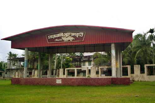
noakhali open cultural center


Tourist Attractions in Noakhali District

Birshrestha Ruhul Amin Memorial Museum, Nijhum Islamd, Bojra Sahi Mosque, Kamolarani Lake, Rongomala Lake, Charbata Steamer Ghat, Queen Luther's Church, Gandhi Asylum, Bashi Khondoker Mosque, Tri- Angle Lake etc.