Wednesday, February 6

Chapai Nawabganj District Information


Chapai Nawabganj District Map, Bangladesh

Chapai Nawabganj District, Bangladesh


Chapai Nawabganj district is located in the western border of Bangladesh. According to geographical formation the district is divided into two parts named Barendra region located in the eastern part of the Mohanoda River and Diar region located in the western part of the same river. Until 1947, Chapainawabganj was a police station under the district of Maldah (India). At the time of partition in 1947, it was upgraded into a Subdivision under Rajshahi district. After the liberation of Bangladesh the region was finally upgraded into a district in 1984. The Geo position of the district is between 24˚22’ to 24˚57’ North latitudes and between 87˚55’ to 88˚23’ east longitude. Chapai Nawabganj district is famous for its mangoes that are greatly delicious. 

Bordered By: Chapai Nawabganj District is bordered by Maldah district of West Bengal (Indian State) to the north, the mighty Padma River and Murshidabad district of West Bengal (Indian State) to the South, Rajshahi and Naogaon districts to the east, the Padma River and Maldah district of west Bengal to the West.

Administration: The area of Chapainawabganj is 1702.55 Sq Km. It is under Rajshahi Division. There are 04 Municipalities in Chapainawabganj named Chapainababganj, Shibgonj, Rohonpur and Nachole. The number of Upazilla (sub district) in Chapai Nawabganj district is 05, named- Chapainababganj, Shibgonj, Nachole, Gomastapur and Volahat containing 45 Unions, 619 Mauzas and 1135 Villages. 

Population: The total population of Chapai Nawabganj district is 16,47,521 (Male- 810,218 and Female- 837,303). Sex ratio is 97:100, Population Density 968/Sq Km and annual growth rate is 1.44%.

Literacy: The Literacy Rate of Chapai Nawabganj district is 42.90% (Male- 41.60% and Female- 44.30%). School attendance rate is 49.80% for 5 to 24 years age group.

Other Important Data: The postal code of Chapai Nawabganj district is 5280 and NWD Code is 0781. Total Parliament seat in Chapai Nawabganj is 03. During the liberation war, Chapai Nawabganj was under Sector Number 07. Urbanization rate of the district is 19.44%. Average rainfall of the region is 186 cm.

Rivers: Padma, Mohanonda, Punarbhaba, Tangon, Maragada, Pagla, Nondaguja etc.

Agro Products: Mango, Guava, Jack-Fruit, Water Melon, Maize, Litchi, Oil seeds Paddy, jute, sugarcane, wheat, Betel Leaf, pulses, guava, Palm etc


Remarkable Personalities from Chapainawabganj District

Diantullah Chowdhury (Hero of Indigo Resistance Movement), Birsresta Captain Mohiuddin Jahangir, Girish Chandra Singha (Land Lord), Prof. Abdur Rahim (Mathematician), Kutub Uddin (Pioneer of Gamvhira), Sayad Ali Ashraf, Sahabuddin Nagori (Singer), Momtaz Uddin Ahmad (Writer and Play Personality), Abdul Hoque, Rafiqunnabi (Artist), Prof. Moniruzzaman Mia, Justice Mainur Reza Chowdhury etc. 

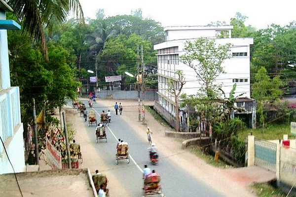
 Chapainawabganj, Bangladesh 

Famous Tourist Attractions Places in Chapainawabganj

Choto Sona Mosque, Rajshadin Gaur of Bokhtier Khalgi, Graveyard and Mango Orchard of Shah Neamot Ullah, Landscape of Babu Dying, Kanchat Rajbari, Sah Suja Hambolkhana, Nowda Tomb, Darsbari, Shibmondir and couple of Temp in Huzabpur, Darashbari Mosque, Royal palace,  Baragharia Kacharibari (Revenue Office), Chapai Mosque, Naoda Stupa (Buddhist monument),  Nachole Palace, Graveyard of Birsresta Captain Mohiuddin Jahangir, Adina College and Idrishi Bhaban etc.


Chittagong District Information


chittagong district map

Chittagong District, Bangladesh


The region is located in the south- eastern part of Bangladesh. Chittagong had been a sea port since the ancient time. Traders from different countries including Arab had business transactions with this port since 9Th century. Sultan Fakruddin Mubarak Shah of Sonargaon conquered Chittagong in 1340. After the defeat of Sultan Giasuddin Mahmud Shah by Sher Shah in 1538 AD, the Arakanise again captured Chittagong. The region was under the kingdom of Arakan during sixth and seventh centuries. During 17Th century the region faced many attacks of Portuguese pirates. Before the Muslim conquered, Chittagong had been either under the control of the Arakans or under the kings of Burma. The Mughal Commander Bujurg Umed Khan expelled the Portuguese pirates from the region and eastablished Chittagong district in 1666 and named Islamabad. Next the region was named Chattla and Chandgaon. The Chittagong Hill- Tracts were separated from Chittagong in 1860. Cox’s Bazar was separated from Chittagong district in 1984 after the liberation of Bangladesh.

Bordered By: Chittagong District is bordered by Feni district and Tripura (Indian State) to the north, Cox’s Bazar district to the south, Rangamati, Bandarban and Khagrachari districts to the east, Noakhali district and the Bay of Bengal to the west.

Administration: The area of Chittagong is 5282.92 Sq Km. It is a divisional Headquarter also. There is a city corporation; 10 Municipalities in Chittagong named Chandanaish, Banskhali, Baroiarhat, Sandwip, Mirsharai, Rangunia, Satkania, Raozan, Patya and Shitakunda. The number of Upazilla (sub district) in Chittagong district is 14, named- Mirsarai, Shitakunda, Raujan, Sandwip, Rangunia, Fatikchari, Hatahazari, Patya, Anowara, Chandanaish, Boalkhali, Bashkhli, Lohagora and Satkania containing 194 Unions, 890 Mauzas and 1267 Villages outside of metro area. 

Population: The total population of Chittagong district is 76,16,352 (Male- 38,38,854 and Female- 37,77,498), Sex ratio 102:100, Population Density 1442/Sq Km and annual growth rate is 1.40%.

Literacy: The Literacy Rate of Chittagong district is 58.90% (Male- 61.10% and Female- 56.70%). School attendance rate is 52.30% for 5 to 24 years age group.

Other Important Data: The postal code of Chittagong district is 4000 and NWD Code is 031. Total Parliament seat in Chittagong is 16. During the liberation war, Chittagong was under Sector Number 01. Urbanization rate of the district is 41.39%, average rainfall is 3378 mm average moisture is 83%.

Remarkable Personalities from Chittagong District

Masterda Surjasen, Priti Lota Owadder, Abdul Karim Sahittobisharod, Principal Abul Quashem (Educationist), Koreshi Magon  Thagure, Mohakobi Alaol, Kalpana Datta, Sayad Owali Ullah (Novelist), Binodbihari Chowdhury, Jahur Ahmad Chowdhury, M A Hannan, M A Aziz, Subrder Rajab Ali (Hero of Shipahi Revoloution), Kajem Ali Master, Comorad Mozaffor Ahmad, Jatindra Mohon Sen, Martyred Nirmol Sen, Amibca Chattargy, Gonesh Ghosh, Abdul Hoque Dovas, Rafiq Uddin Shiddique, Brozen Sen, Sharat Kanungo, Kalipod Chattargy, Prof. Pulin Day, Amor Sen, Comored Abdus Satter, A K Khan, Chowdhury Harunur Rashid, Captain Abul Quashem, Shirajul Hoque Mia, Khanbahadur, Natun Chandra Shingha, Probal Chowdhury, Sujat Roy, Ayub Bacchu, Nakib Khan, Roby Chowdhury, Partha Barua Dr Keshob Sen, Dr Harihar Datta, Jotirmoye Chowdhury, Kabial Romesh Shil, Shah Muhammad Sagir (Poet)  etc.

chittagong, bangladesh

Famous Tourist Places in Chittagong District

Fays Lake, Potenga Sea Beach, Chittagong Zoo, Chittagong University, Graveyard of Bayajid Bostami, Graveyard of Shah Amanat, War Cemetery, Zia Memorial Museum, Asian Women University, Fauzdarhat Cadet College, Mahuri Project, Batali Hill, Chandranath Hill of Shitakunda, Hot Water Fall, Bashkhali Eco Park, Parky Sea Beach in Anowara, Bangladesh Military Academy, Marine Academy etc.


Friday, February 1

Chuadanga District Information


chuadanga district map

Chuadanga District, Bangladesh

Chuadanga is the south- western borderline district of Bangladesh. The previous name of the region was “Gangaridhi.” It is thought from the records of the Greek historians and geographical formations of the region that it was a part of the kingdom of Gangaridhi and there was a city called Gangey in the region. In the British East India period, Chuadanga along with Kushtia region was a under Rajshahi district. Then the region was included with Pabana district in 1828. In the time of partition in 1947, excepting Krishnagar police station, the whole territory of Chuadanga sub-division was included in Kushtia district. The Wahabi Movement (1831), Faraizi Movement (1838-47), Sepoy Revolt (1857), Indigo Rebellion (1859-60), Khilafat Movement (1920), Swadeshi Movement (1906), Non Cooperation Movement, Violation of Law Movements (1920-40), Quit India Movement, August Revolt (1942) etc are the remarkable chapters of the region. After the liberation of Bangladesh, Chuadanga was turned into a district on 16 February 1984. The one and only Alcohol production factory of Bangladesh named Keru and Company located in the region.

Bordered By: Chuadanga District is bordered by Kushtia district to the northeast, Jhenaidah district to the southeast, Meherpur district to the northwest and Nadia district of West Bengal (Indian State) to the southwest.

Administration: The area of Chuadanga is 1174.10 Sq Km. It is under Khulna Division. There are 04 Municipalities in Chuadanga named Chuadanga, Alamdanga, Damurhuda and Jibonnagor. The number of Upazilla (sub district) in Chuadanga district is 04, named- Chuadanga, Alamdanga, Damurhuda and Jibonnagor containing 32 Unions, 345 Mauzas and 521 Villages. 

Population: The total population of Chuadanga district is 11,29,015 (Male- 564,819 and Female- 564,196), Sex ratio 100:100, Population Density 962/Sq Km and annual growth rate is 1.13%.

Literacy: The Literacy Rate of Chuadanga district is 45.90% (Male- 46.90% and Female- 44.90%). School attendance rate is 51.90% for 5 to 24 years age group.

Other Important Data: The postal code of Chuadanga district is 9000 and NWD Code is 0761. Total Parliament seat in Chuadanga is 02. During the liberation war, Chuadanga was under Sector Number 08. Average rainfall of Chudanga district is 1467 mm and Urbanization rate is 27.12%.

Rivers: Naboganga, Mathavanga, Vairab, Kumar, Chitra etc. 

Agro Products: Paddy, Jute, Sugarcane, Betel Leaf etc.

Remarkable Personalities  from Chuadanga District

Atul Kridna Saha (Leader of the Movement against British), Ananta Hari Mitra, Amia Kumar Roy, Advocate Younous Ali, Islam Uddin Malik, Moslem Ali Biswas (Journalist), Janki Nath Ghosal, Sarnakumari Debi, Sreehori Roy, Akram Ahmed (Bir-Uttam), Sree Hori Roy (Leader of Nil Rebellion) Kali Proshanna Chattergy (Editor), Dr Radha Binod Paul, Solaiman Haq Jowarder (Selun), Mr. Ali Ajgor (Togor) etc.
 the one and only alcohol producer in bangaldesh

Famous Tourist Places in Chuadanga District

Ershad Baag and Fisheries, Dingedah Bazar, Alamdanga Rail-Way Station, Dorshana Rail-Way Station, Mazar of Khaza Malik-ul-Gaus (R), Dingedaha Meteri Fair, Goruy Tipy, Three domed Chuadanga Bôro Mosque, Gholdari Mosque, Chuadanga Circuit House, Natudah Atkabar, Hajar Duari School (Damuŗhuda), Karpashdaņa Neelkuţi, Gholdari Neelkuti, Karew and Company etc.

Comilla District Information


atlas of comilla


Comilla District, Bangladesh


Comilla district is located in the south eastern part of Bangladesh. The naming of Comilla is debatable by historians. But among the current opinions fairly acceptable opinion found in the travel Writing of Chainik traveler “Wang Choang” when he traveled the Samtat state. In his description we found a name “Kiamolonkia” that turned into Comilla. A large portion of historians accept the opinion. The Comilla region was once under the ancient Samatat state and next included in Tripura State. This district came under the rule of the kings of the Harikela in the ninth century. Lalmai and Mainamati were once ruled by Deva dynasty (18Th century) and Chandra dynasty (during 10Th and up to mid of eleventh century). It came under the rule of East India Company in 1765. This district was established as Tripura district in 1790. Peasants Movement (1764), Anti Partition Movement (1905), Mass Movement (1969) etc are the notable chapters of the region.  In the Pakistan Period, the region was renamed Comilla in 1960. Chandpur and Brahmanbaria subdivisions were then included in Comilla District. The Geo position of the district is between 23˚01’ to 24˚11’ North latitudes and between 90˚34’ to 91˚22’ east longitude.

Bordered By: Comilla District is bordered by Narayanganj and Brahmanbaria district to the north, Noakhali and Feni district to the south, Tripura (Indian State) to the east, Chandpur and a part of Munshiganj district to the west.

Administration: The area of Comilla is 3146.30 Sq Km. It is under Chittagong Division. There are 10 Municipalities in Comilla named Baruna, Chauddagram, Homna, Comilla, Comilla Dakkhin, Nangalkot, Chandina, Daudkandi, Debidawar and Laksham. The number of Upazilla (sub district) in Comilla district is 16, named- Comilla Sadar, Homna, Laksham, Muradnagor, Debidar, Barura, Daudkandi, Burichong, Chandina, Chaddagram, Nagolcot, Bhrammonpara, Meghna, Titas, Monohorgonj and Sadar Dokkhin containing 185 Unions, 2455 Mauzas and 3532 Villages. 

Population: The total population of Comilla district is 53,87,288 (Male- 25,75,018 and Female- 28,12,270). Sex ratio is 92:100, population density 1712/Sq Km and annual growth rate is 1.58%.

Literacy: The Literacy Rate of Comilla district is 53.30% (Male- 54.10% and Female- 52.60%), school attendance rate is 54.90% for 5 to 24 years age group.

Other Important Data: The postal code of Comilla district is 3500 and NWD Code is 081. Total Parliament seat in Comilla is 11. During the liberation war, Comilla was under Sector Number 02. Urbanization rate of the district is 15.60%.

Rivers: Meghna, Gomati, Titas, Dakatia, Kakri etc.

Agro Products: Paddy, Jute, Wheat, Chilly, Onion, Garlic, Peanuts, Sugarcane, Yam, vegetables, Oilseed etc.

Remarkable Personalities from Comilla District

Prof. Mozaffor Ahmad, Dhrindra Nath Datta (Politician), A. T. M. Samsul Hoque (Politician), Khondaker Mostaq Ahmad (Ex-president), Azit Kumar guha (Writer), Anis Chowdhury (Writer), Nawab Fayjunnessa Chowdhury, Buddhyadeb Basu (Novelist), Sachin Deb Barman (Singer, composer & music director), Sursagor Himanshu Dutta,  Abul Khyer Muslehuddin (Writer), Monayem Sarker (Politician), Mobasher Ali (Literate Personality), Abdul Kadir (Poet), Moteher Hossain Chowdhury (Writer), Gias Kamal Chowdhury (Journalist), Basonta Kumar Majumder, Yousouf Abdullah Harun (Politician and Business Personality), Dr. Zobaida Hannan, Mahasthabir Shilvadra (great Buddhist monk & pandit), M.K. Anwar (Ex-minister), Shib Narayan Das (Freedom Fighter),  Air Vice-Marshall Mohammad Jamaluddin (ex-Chief of Staff of Bangladesh Air Force),Barrister Shafiq Ahmed (Politician), Advocate Abdul Motin Khosru, Kailashchandra singha (Historian), Mohamed Ali Azam (Educationist) etc.

comilla, bangladesh

Famous Tourist Attractions in Comilla District

Kort-Bari, BARD, Moynamoti, Lalmay Hill, Shalbon Amorous Diversion, Second World War cemetery, Meghna-Gomoti Bridge, Bakhrabad Gas Field, Dhormosagor, Jagannath Bari Temple and Lake, Lateshor Lake, Core of Buddhist Civilization, Pashchimgaon Nawab Bari, Victoria College, Comilla Zilla School, Kutila Mura, Charandra Mura, Rupban Mura, Itakhola Mura, Satera Ratna Mura, Ranir Banglar Pahar, Ananda Bazar Palaces, palaces of Bhoj King, Shah Suja Mosque, Chandimata Mandir, Chandala Shiva Mandir, Mazars of Panch Pir (Five Saints), Harimangal Math, Ramnagar elongated Math, Saitshala Rammahan Mandir, Hasnabad Math, Town Hall Memorial etc.