Wednesday, December 18

Rangpur District Information


atlas of rangpur district

Rangpur District, Bangladesh


Rangpur district is located in the northern part of Bangladesh. The previous name of the region was Mughalbasa. Mansingh, the commander of Mughal Emperor Akbar conquered part of the region in 1575 AD. Rangpur came under the Mughal rule completely in 1686 AD. Mughalbasa and Mughalhat of the region (currently in Kurigram district) still bear marks of the Mughal rule in the region. During the Mughal rule Rangpur was under the sarker of Ghoraghat. During the early period of the East India Company rule, Fakir- Sannyasi resistance and peasant rebellion were broke out in the region. The district is formed in 1772 AD. The Geo position of the district is between 15˚03’ to 26˚00’ North latitudes and between 88˚57’ to 89˚32’ east longitude.

Rangpur District Bordered By

Rangpur District is bordered by Nilphamari district to the north, Gaibandha district to the south, Kurigram district to the east, Dinajpur district to the west.

Administration: The area of Rangpur is 2400.56 Sq Km. It is also a Divisional Headquarter. There is a city corporation contains the area of 43 Sq Km; 02 Municipalities in Rangpur named Badargonj and Kaunia. The number of Upazilla (sub district) in Rangpur district is 08, named- Badarganj, Mithapukur, Gangachara, Kaunia, Rangpur Sadar, Pirgachha, Pirganj and Taraganj and Gozaria containing 84 Unions, 1191 Mauzas and 1492 Villages outside of metro area. 

Population data of Rangpur District

 The total population of Rangpur district is 31,69,614. Sex ratio is 103.79:100, Population Density 1320/Sq Km and annual growth rate is 0.85%.

Literacy: The Literacy Rate of Rangpur district is 80.94%. School attendance rate is 73.20% for 5 to 24 years age group.

Other Important Data: The postal code of Rangpur district is 5400 and NWD Code is 0521. Total Parliament seat in Rangpur is 06. During the liberation war, Rangpur was under Sector Number 06. Average rainfall of the district is 219.45 mm and urbanization rate of the district is 15.37% and average rainfall is 219.45 mm. The main tribes of the region are Urao, Pahari, Mushar, Saotal, Pahan Turi etc.

Rivers: Teesta, Jamuneshari, Ghagot, Kartoa, Chikli, Akhira etc.

Agro Products: Paddy, Jute, Potato, Tobacco, Wheat, Oil seeds, Vegetable etc.


Remarkable Personalities from Rangpur District

Justice A. S. M. Sayem, William Beveridge (British economist), Rahim Uddin Varasha, (Politician), Monajat Uddin, Begum Rokeya, Shah Abdul Hamid (Politician), Sheikh Fazlul Karim (Poet and Writer), Haralal Roy (Bengal Grammerist), Dr Owazed Mia (Scientist), Monju Sarker, Debi Prashad Roy Chowdhury, Hussain Muhammad Ershad ( Politician), Hayat Mamud (Bangla Grammerist), Prof. Azgar Ali, Major General Mustafizur Rahaman, Nasir Hossain (Cricketer), Anisul Hoque (Writer) etc.

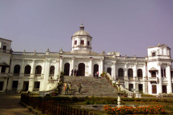
rangpur royal palace


Tourist Attractions in Rangpur District

Tajhat Royal Palace, Payrabanda Royal Palace, Pirgacha Debi Chowdhurani Royal Palace, Shibchandra Roy Royal Palace in Itakumari, Nilkomol, Karmaikel College, Graveyard of Lalbibi, Payrabonda Village, Shrine of Hazrat Mawlana Keramot Ali Jainpuri (R), Teesta Barrege, Monument on the Martyr of 71, Shrine Park, Tiklir Bil, Darier Bil and Fort, Mohimagonj, Shympur Sugar Mill, Town Hall, Noy Gambuj Mosque, Rangpur Zoo, Benarashi Palli, Vinnajagat Amusement Park, Laldighi Nine Gombuj Mosque, Kajitari Mosque in Mahiganj, Ananda Moth in Kaunia, Benarashi Palli  etc.


Thursday, December 12

Satkhira District Information


atlas of satkhira district

Satkhira District, Bangladesh


Satkhira district is located in the south western part of Bangladesh. Satkhira region was once a part of the ancient Banga Janapada. The previous name of Satkhira region was “Satgharia” (established by Zamindar Pran Nath Roy Chowdhury). During the permanent settlement, Bishnuram Chattergy, an official of Raja Krishna Chandra of Nadia, purchased Buran Pargana by auction in 1772 and settled Satgharia village. Prananath Roy Chowdhury, the son of Bishnuran Chattergy made remarkable development in the region. In 1781, most of the areas of Jessore, Faridpur and Khulna were brought under a single administration. But while peasant movement spread over the region against the oppressions of indigo planters and the local landlords in 1801, the British East India Company established a subdivision at Satgharia under Jessore district to control indigo revolt and to strengthen local administration in 1861. By this time “Satgharia” turned into “Satkhira” in the records of the British Company. After the liberation of Bangladesh, the subdivision was turned into a district in 1984. The Geo position of the district is between 21˚48’ to 22˚58’ North latitudes and between 88˚55’ to 89˚20’ east longitude.

Satkhira District Bordered By

Satkhira District is bordered by Jessore district to the north, The Bay of Bengal to the south, Khulna district to the east, 24 Pargana district of West Bengal (Indian State) to the west.

Administration: The area of Satkhira is 3817.29 Sq Km. It is under Khulna Division. There are two Municipalities in Satkhira named Satkhira and Kalaroa. The number of Upazilla (sub district) in Satkhira district is 08, named- Satkhira, Kaligonj, Debhata, Tala, Ashasuni, Shyamnogor, Kalaroa and Patkelghata containing 79 Unions, 916 Mauzas and 1440 Villages. 

Satkhira District Population Data

The total population of Satkhira district is 21,96,582 (Male- 1093554 and Female- 11,02,936), sex ratio 98:100, population Density 574/Sq Km and annual growth rate is 0.90%.

Literacy: The Literacy Rate of Satkhira district is 53.32% . School attendance rate is 61.23% for 5 to 24 years age group.

Other Important Data: The postal code of Satkhira district is 9400 and NWD Code is 0471. Total Parliament seat in Satkhira is 04. During the liberation war, Satkhira was under Sector Number 08 & 09. Urbanization rate of the district is 9.95%. The region is average 16 ft high on sea level.

Rivers: Raymongol, Kalindi, Kakshiali, Kapotakkhya, Pangashia, Hariavanga, Maloncha, Betna, Harinvhanga, Betna, Chunar, Ishamoti etc.

Agro Products: Paddy, Jute, Sugarcane, Wheat, Potato, Mango, Mastered, Onion, Betel, Shrimp etc.

Remarkable Personalities from Satkhira District

Md Wajed Ali (Writer and Journalist), Sheikh Lutfor Rahaman, Afjol Hossain, Golam Moinuddin, Khan Bahadur Ahsanullah, Land Lord Pran Nath Roy Chowdhury, King Haricharan Roy Chowdhury, Thaguredas Mukharjee (Writer), Khan Abdul Wali (Multi Linguist), Sheikh Abul Quashem (Politician), Dr Bidhan Chandra Roy (Politician), Kazi Samsur Rahaman, Shikander Abu Jafor (Poet), Tagore Das Mukhargee, Taja Prattyapadditta (Land Lord), Azizun Nesa Khatun (Writer), Abdul Hamid Gazi (Famous Tiger Hunter) etc.

shayamnagor mohshin degree college, satkhira


Tourist Attractions in Satkhira District

Sundarban, Bura Kha Lake, Mandarbaria Sea Beach, Sapnabari, Mojaffar Garden and Resort, Dokkhin Talpotti, Shrine of Nalta, Shrine of Gunakarkati, Chaygharia Jora Shib Mondir, Raja Prattyapadditta Hammamkhana, Shamsundar Temple, Karimondir, Sonabaria Moth and Temple, Jahajghata, Tetulia Jame Mosque etc.